River Wey Navigation: Parvis Wharf
Introduction
The photograph on this page of River Wey Navigation: Parvis Wharf by Nigel Cox as part of the Geograph project.
The Geograph project started in 2005 with the aim of publishing, organising and preserving representative images for every square kilometre of Great Britain, Ireland and the Isle of Man.

There are currently over 7.5m images from over 14,400 individuals and you can help contribute to the project by visiting https://www.geograph.org.uk
River Wey Navigation: Parvis Wharf
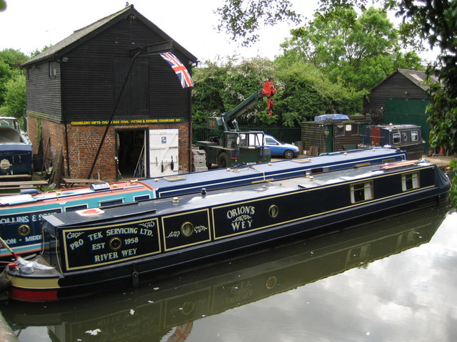
Image: © Nigel Cox Taken: 20 May 2008
Parvis Wharf is located on the south side of the Old Parvis Road bridge. It dates back to at least 1775 and is the last surviving rural wharf on the canal. The building on the left is the Old Grist Mill believed to have been built around 1800.
Images are licensed for reuse under creativecommons.org/licenses/by-sa/2.0
Image Location
Latitude
51.340108
Longitude
-0.486792