A choice of public right of way
Introduction
The photograph on this page of A choice of public right of way by Kate Jewell as part of the Geograph project.
The Geograph project started in 2005 with the aim of publishing, organising and preserving representative images for every square kilometre of Great Britain, Ireland and the Isle of Man.

There are currently over 7.5m images from over 14,400 individuals and you can help contribute to the project by visiting https://www.geograph.org.uk
A choice of public right of way
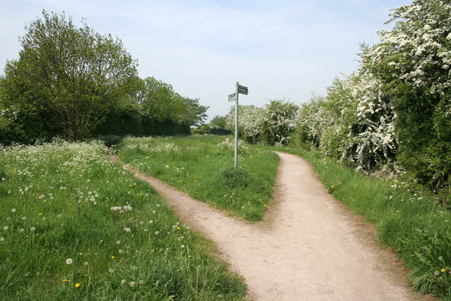
Image: © Kate Jewell Taken: 12 May 2008
Public footpath to the left and public bridleway to the right. The green area in the middle is the filled in Nottingham Canal. On the OS 1:50,000 map this is shown as still in water but has been filled in for some time. Since 1977, the Broxtowe Borough Council has owned and maintained the upstream sections of the canal from Wollaton to Langley Mill as a nature reserve and walking trail. This part is at Trowell.
Images are licensed for reuse under creativecommons.org/licenses/by-sa/2.0
Image Location
Latitude
52.955747
Longitude
-1.282339