St. Paul's Parish Church Hall, Diamond Grange
Introduction
The photograph on this page of St. Paul's Parish Church Hall, Diamond Grange by P Flannagan as part of the Geograph project.
The Geograph project started in 2005 with the aim of publishing, organising and preserving representative images for every square kilometre of Great Britain, Ireland and the Isle of Man.

There are currently over 7.5m images from over 14,400 individuals and you can help contribute to the project by visiting https://www.geograph.org.uk
St. Paul's Parish Church Hall, Diamond Grange
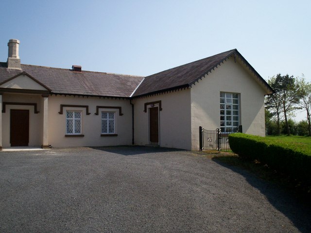
Image: © P Flannagan Taken: 7 May 2008
The portion of the building on the right was the old Parish Church, Diamond Grange, Annagora Road. Attached to it is the former Schoolhouse. In recent years, both buildings have been converted into church halls used by the Sunday School and other organizations.
Images are licensed for reuse under creativecommons.org/licenses/by-sa/2.0
Image Location


Leaflet Map data © OpenStreetMap
Latitude
54.423131
Longitude
-6.533461