Old buildings and Kingston Bridge at Anderston
Introduction
The photograph on this page of Old buildings and Kingston Bridge at Anderston by Thomas Nugent as part of the Geograph project.
The Geograph project started in 2005 with the aim of publishing, organising and preserving representative images for every square kilometre of Great Britain, Ireland and the Isle of Man.

There are currently over 7.5m images from over 14,400 individuals and you can help contribute to the project by visiting https://www.geograph.org.uk
Old buildings and Kingston Bridge at Anderston
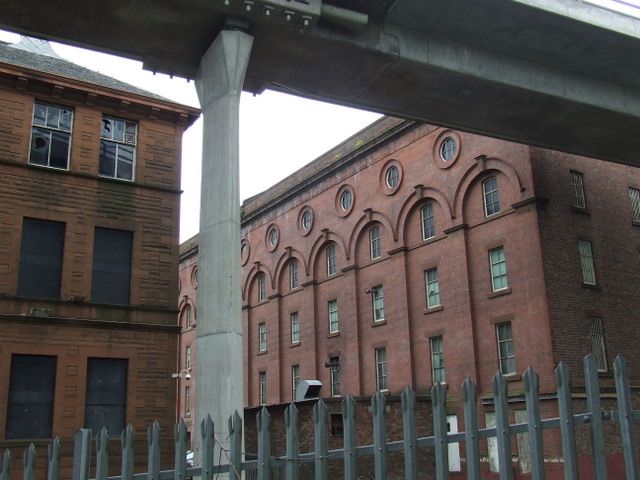
Image: © Thomas Nugent Taken: 17 May 2008
Much of Anderston was bulldozed to make way for the Kingston Bridge, but these old buildings survive in its shadow. On the left is Washington Street School, which appears to be disused, to the right is The Pentagon Centre.
Images are licensed for reuse under creativecommons.org/licenses/by-sa/2.0
Image Location
Latitude
55.858506
Longitude
-4.268341