
No Ding Quarry
Introduction
The photograph on this page of No Ding Quarry by michael ely as part of the Geograph project.
The Geograph project started in 2005 with the aim of publishing, organising and preserving representative images for every square kilometre of Great Britain, Ireland and the Isle of Man.

There are currently over 7.5m images from over 14,400 individuals and you can help contribute to the project by visiting https://www.geograph.org.uk
No Ding Quarry
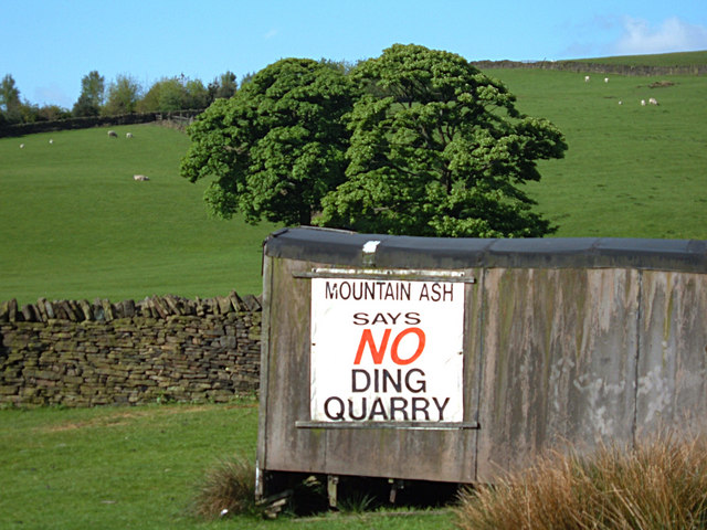
Image: © michael ely Taken: 18 May 2008
This sign on an old shed is by the side of Rooley Moor Road at Catley Lane Head. Ding Quarry (stone quarry) has been unused for years but there is a planning application before Rochdale BC to re-open it. This will generate heavy traffic on the Pennine Bridleway National Trail - a superb recreational route over a wild moor. Local residents aren't too keen on it either. Ding Quarry can be seen here Image
Images are licensed for reuse under creativecommons.org/licenses/by-sa/2.0
Image Location

Latitude
53.639095
Longitude
-2.19628