AA Town marker
Introduction
The photograph on this page of AA Town marker by Colin Wynne-Parle as part of the Geograph project.
The Geograph project started in 2005 with the aim of publishing, organising and preserving representative images for every square kilometre of Great Britain, Ireland and the Isle of Man.

There are currently over 7.5m images from over 14,400 individuals and you can help contribute to the project by visiting https://www.geograph.org.uk
AA Town marker
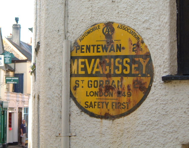
Image: © Colin Wynne-Parle Taken: 15 Jun 2004
In the earlier part of the last century most towns and villages had their own AA signs, a circular enamelled disk in black and yellow, giving the name of the place and the distance to the neighbouring towns and London.
Images are licensed for reuse under creativecommons.org/licenses/by-sa/2.0
Image Location


Leaflet Map data © OpenStreetMap
Latitude
50.267033
Longitude
-4.786677