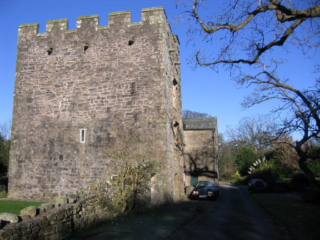
Branthwaite Hall.
Introduction
The photograph on this page of Branthwaite Hall. by John Holmes as part of the Geograph project.
The Geograph project started in 2005 with the aim of publishing, organising and preserving representative images for every square kilometre of Great Britain, Ireland and the Isle of Man.
There are currently over 7.5m images from over 14,400 individuals and you can help contribute to the project by visiting https://www.geograph.org.uk

Image: © John Holmes Taken: 18 Nov 2005
A very nice if big house. A late 14th or early 15th century pele tower with a 16th century hall wing; there are also 17th century additions. In 1985 the building was restored and converted into offices by the National Coal Board; it was sold privately in 1992. The tower measures 9.8m x 8.2m over walls 1.5m thick and is well preserved with a vaulted basement.

