Dean Lane/A23 junction
Introduction
The photograph on this page of Dean Lane/A23 junction by Ian Capper as part of the Geograph project.
The Geograph project started in 2005 with the aim of publishing, organising and preserving representative images for every square kilometre of Great Britain, Ireland and the Isle of Man.

There are currently over 7.5m images from over 14,400 individuals and you can help contribute to the project by visiting https://www.geograph.org.uk
Dean Lane/A23 junction
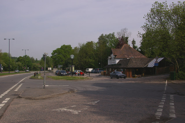
Image: © Ian Capper Taken: 10 May 2008
The building in the background used to be a Little Chef; it is now a Starbucks. The tyre marks in the road are because of this junction's unofficial use as a point of U turn for traffic travelling to/from the M23 from/to Merstham and Redhill via the A23. The layout of the junction seems to have been designed to enable such manoeuvres to take place, which is somewhat surprising given that it involves cutting across and rejoining what is often a continuous stream of traffic. Longer term, various proposals have been put forward for a roundabout hereabouts to allow this to be done more safely (and officially) although as with many such consultations, the powers that be seem to be taking an eternity to decide on which of the alternatives should be built, after which funding will need to be secured, so when it will actually happen is anyone's guess. On the far right of the photo can be seen a section of wall. This is no ordinary wall; instead it is one of the few visible remnants of the Croydon, Merstham and Godstone Iron Railway, being the parapet of the bridge which originally carried Dean Lane over the railway - see Image and Image for a closer view of the bridge.
Images are licensed for reuse under creativecommons.org/licenses/by-sa/2.0
Image Location
Latitude
51.286968
Longitude
-0.15483