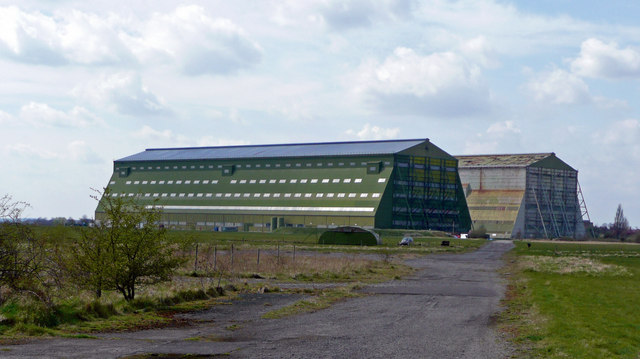
Cardington Airship Hangars
Introduction
The photograph on this page of Cardington Airship Hangars by Jonathan Billinger as part of the Geograph project.
The Geograph project started in 2005 with the aim of publishing, organising and preserving representative images for every square kilometre of Great Britain, Ireland and the Isle of Man.
There are currently over 7.5m images from over 14,400 individuals and you can help contribute to the project by visiting https://www.geograph.org.uk

Image: © Jonathan Billinger Taken: 15 Apr 2008
Viewed from the east. See Image for excellent description and links. The nearer shed is No.2 shed. From 1970 onwards it was leased by the Fire Research Station (based in Borehamwood, Herts) as a large scale test facility, where fires could be lit in relatively still-air conditions. It eventually became part of the Building Research Establishment, which became BRE Ltd. in 1997, when privatised out of the civil service. No.2 hangar is in much better condition than No. 1, as it was completely reclad in the late 1980s. Description augmented by another member.

