Bridleway to the Top
Introduction
The photograph on this page of Bridleway to the Top by Tony Atkin as part of the Geograph project.
The Geograph project started in 2005 with the aim of publishing, organising and preserving representative images for every square kilometre of Great Britain, Ireland and the Isle of Man.

There are currently over 7.5m images from over 14,400 individuals and you can help contribute to the project by visiting https://www.geograph.org.uk
Bridleway to the Top
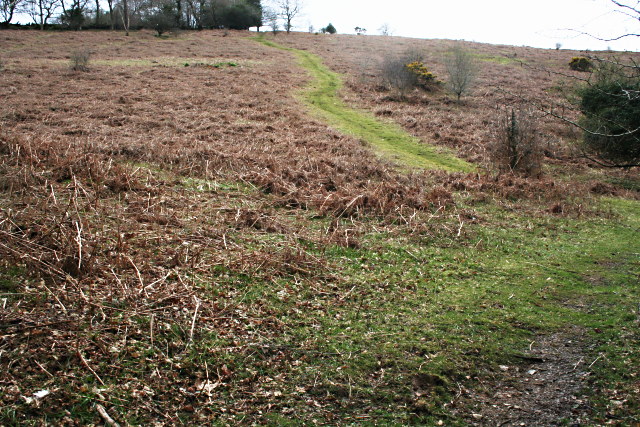
Image: © Tony Atkin Taken: 13 Apr 2008
A bridleway cuts a green line of grass through the dead bracken stalks which cover this hillside. In the Summer this hillside will be a sea of bracken. Evidently the hillside has not had the right grazing animals on it to keep the bracken at bay.
Images are licensed for reuse under creativecommons.org/licenses/by-sa/2.0
Image Location


Leaflet Map data © OpenStreetMap
Latitude
50.507637
Longitude
-4.142002