Bus on Chandos Street, Netherfield – 1986
Introduction
The photograph on this page of Bus on Chandos Street, Netherfield – 1986 by Alan Murray-Rust as part of the Geograph project.
The Geograph project started in 2005 with the aim of publishing, organising and preserving representative images for every square kilometre of Great Britain, Ireland and the Isle of Man.

There are currently over 7.5m images from over 14,400 individuals and you can help contribute to the project by visiting https://www.geograph.org.uk
Bus on Chandos Street, Netherfield – 1986
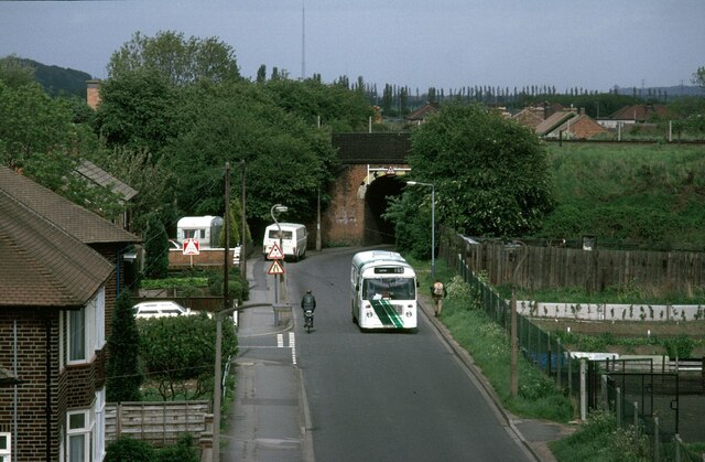
Image: © Alan Murray-Rust Taken: 1 May 1986
In the run-up to the deregulation of bus services in October 1986, City of Nottingham Transport introduced a series of ‘Accessline’ services using small buses to reach areas that could not be served by full size buses. The idea was that these areas would not be attractive to possible competitors after deregulation and that passengers would be attracted to use these localised services rather than walk to main roads. These services were never economically viable and in most cases services were withdrawn soon after deregulation and have not been replaced since. Chandos Street is one of the few sections where a limited service has been maintained, although the route is substantially different from the Accessline service. The railway bridge carried the line up to Gedling Colliery, at that time still operational. Originally it formed part of the Great Northern Railway’s very roundabout route from Nottingham to Derby, via Colwick, Basford, and Ilkeston.
Images are licensed for reuse under creativecommons.org/licenses/by-sa/2.0
Image Location
Latitude
52.968391
Longitude
-1.070246