Foul Lane
Introduction
The photograph on this page of Foul Lane by Oliver Dixon as part of the Geograph project.
The Geograph project started in 2005 with the aim of publishing, organising and preserving representative images for every square kilometre of Great Britain, Ireland and the Isle of Man.

There are currently over 7.5m images from over 14,400 individuals and you can help contribute to the project by visiting https://www.geograph.org.uk
Foul Lane
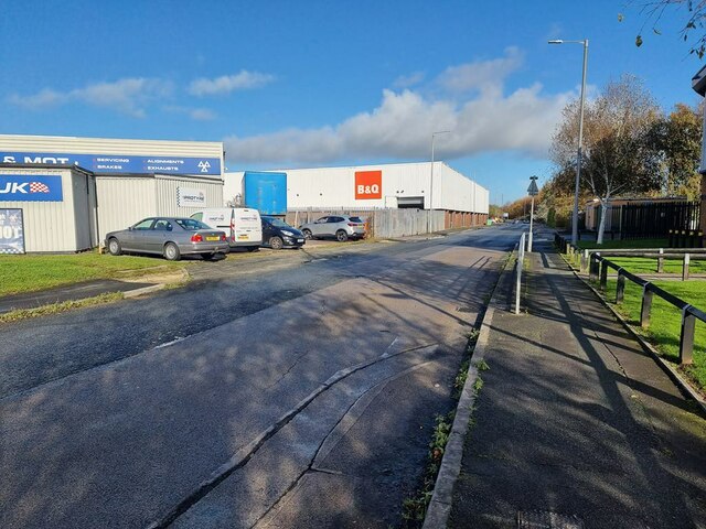
Image: © Oliver Dixon Taken: 22 Oct 2024
In the 1950s, Foul Lane was a cinder road alongside a railway embankment and was the closest to home in Scarisbrick New Road that could remotely be called a country walk. Protyre, the tyre depot to the left, stands on the site of the former Kew Gardens station (closed 1938). A railway embankment, built for the Liverpool, Southport and Preston railway ran parallel to Foul Lane through what is now the B and Q warehouse on the Meols Cop Retail Park. The railway was closed for passengers in 1938, although the track was not removed until 1964 after which the embankment was removed and all traces of it obliterated.
Images are licensed for reuse under creativecommons.org/licenses/by-sa/2.0
Image Location
Latitude
53.63255
Longitude
-2.968561