Lost Summer House
Introduction
The photograph on this page of Lost Summer House by Pete Marrison as part of the Geograph project.
The Geograph project started in 2005 with the aim of publishing, organising and preserving representative images for every square kilometre of Great Britain, Ireland and the Isle of Man.

There are currently over 7.5m images from over 14,400 individuals and you can help contribute to the project by visiting https://www.geograph.org.uk
Lost Summer House
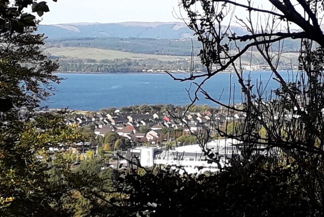
Image: © Pete Marrison Taken: 10 Oct 2024
To the south east of Camis House, is a hill overlooking Craigendoran. In 1860 the map shows the name “Summer Ho”. By 1890, the map shows just a dot. All that remains is a ragged stone base. The length is approximate 20 metres. The Summer House was probably rotten many years ago. There is a great view across the loch. The Summer House was about 30 metres up from the old Ice House.
Images are licensed for reuse under creativecommons.org/licenses/by-sa/2.0
Image Location
Latitude
55.994636
Longitude
-4.702091