
The ruins of St Mary's Priory
Introduction
The photograph on this page of The ruins of St Mary's Priory by Evelyn Simak as part of the Geograph project.
The Geograph project started in 2005 with the aim of publishing, organising and preserving representative images for every square kilometre of Great Britain, Ireland and the Isle of Man.

There are currently over 7.5m images from over 14,400 individuals and you can help contribute to the project by visiting https://www.geograph.org.uk
The ruins of St Mary's Priory
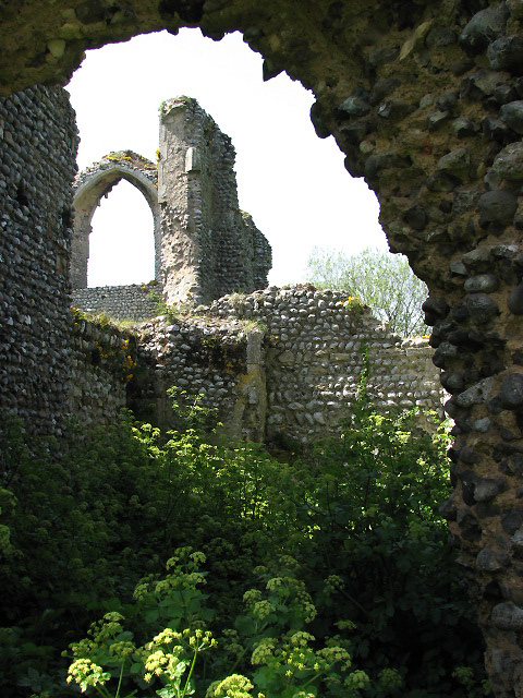
Image: © Evelyn Simak Taken: 5 May 2008
View west into the former chapel north of the nave. Believed to have been founded by Margaret Cressey in 1216 for a small community numbering two to six Augustine canons (ordained priests who lived according to the rules of St Augustine and served as parish priests for nearby churches). In all probability the adjoining land was farmed by monks; the precinct consisted of agricultural buildings, brewery, guest house, wash house, latrines and probably a smithy. The priory was dissolved in 1539. Its church survived because it was converted into farm buildings. Presently owned by the Norfolk Historic Buildings Trust and in the guardianship of the Norfolk County Council, the ruin is accessible via a public footpath > http://www.geograph.org.uk/photo/790304. Entering through the main west entrance, one steps into the nave with a side chapel to the north; the church was of a cruciform shape and the crossing (underneath the tower) was located at the eastern end of the nave. There used to be a north and a south transept, and a chapter house adjacent to the latter. The east end was formed by the presbytery, there was another chapel east of the north transept.
Images are licensed for reuse under creativecommons.org/licenses/by-sa/2.0
Image Location

Latitude
52.939081
Longitude
1.223841