View Down Ivatt Way N17
Introduction
The photograph on this page of View Down Ivatt Way N17 by John Kingdon as part of the Geograph project.
The Geograph project started in 2005 with the aim of publishing, organising and preserving representative images for every square kilometre of Great Britain, Ireland and the Isle of Man.

There are currently over 7.5m images from over 14,400 individuals and you can help contribute to the project by visiting https://www.geograph.org.uk
View Down Ivatt Way N17
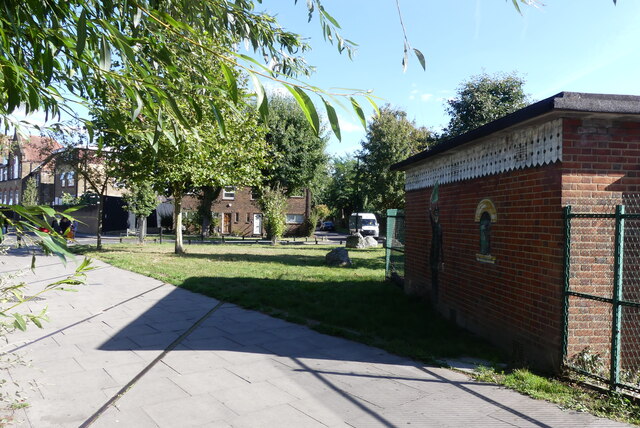
Image: © John Kingdon Taken: 16 Sep 2024
The housing in the centre of the photo sits on the old railway alignment and there is now a footpath between Langham Road and Downhills Park Road where once a footbridge crossed the line. The two sets of rails embedded in the pathway are fakes: they are far too wide for the UK standard gauge tracks that once sat there. The artwork on the wall of the electricity substation gives a nod to a bygone age but strikes me at kitsch.
Images are licensed for reuse under creativecommons.org/licenses/by-sa/2.0
Image Location
Latitude
51.590448
Longitude
-0.097229