Limehouse Cut (1)
Introduction
The photograph on this page of Limehouse Cut (1) by Nigel Cox as part of the Geograph project.
The Geograph project started in 2005 with the aim of publishing, organising and preserving representative images for every square kilometre of Great Britain, Ireland and the Isle of Man.

There are currently over 7.5m images from over 14,400 individuals and you can help contribute to the project by visiting https://www.geograph.org.uk
Limehouse Cut (1)
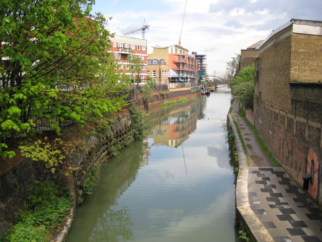
Image: © Nigel Cox Taken: 1 May 2008
The Limehouse Cut was built to provide a navigable short-cut from the River Thames at Limehouse Basin north-east to the River Lee Navigation at Bromley-by-Bow, thus avoiding the long meandering curves of the lower reaches of the River Lee at Bow Creek, and the long bend in the River Thames around the Isle of Dogs. It was authorised by the River Lee Act of 1766, and completed in 1770 so it is effectively the oldest canal in London. This view was taken from the Britannia Bridge looking in the direction of Bromley-by-Bow.
Images are licensed for reuse under creativecommons.org/licenses/by-sa/2.0
Image Location


Leaflet Map data © OpenStreetMap
Latitude
51.512296
Longitude
-0.031454