Shittlehope Burn Farm
Introduction
The photograph on this page of Shittlehope Burn Farm by Robert Graham as part of the Geograph project.
The Geograph project started in 2005 with the aim of publishing, organising and preserving representative images for every square kilometre of Great Britain, Ireland and the Isle of Man.

There are currently over 7.5m images from over 14,400 individuals and you can help contribute to the project by visiting https://www.geograph.org.uk
Shittlehope Burn Farm
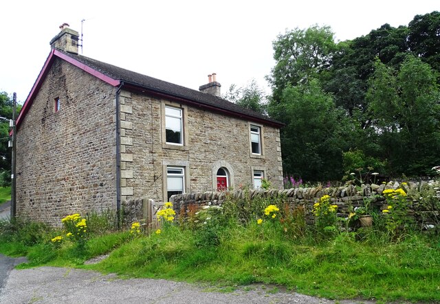
Image: © Robert Graham Taken: 23 Jul 2024
An old farmstead on the outskirts of Stanhope in Weardale. This is the farmhouse, probably the one shown on the first Ordnance Survey map of 1861. The fact that it's detached, with the outbuildings on the other side of the road, suggests that it's 19th century in origin. Farms from earlier times usually were of a linear layout in this area, with the byres attached to the house.
Images are licensed for reuse under creativecommons.org/licenses/by-sa/2.0
Image Location


Leaflet Map data © OpenStreetMap
Latitude
54.741017
Longitude
-1.996706