Old Milestone by the former A303, west of Horton Cross
Introduction
The photograph on this page of Old Milestone by the former A303, west of Horton Cross by Tim Beer as part of the Geograph project.
The Geograph project started in 2005 with the aim of publishing, organising and preserving representative images for every square kilometre of Great Britain, Ireland and the Isle of Man.

There are currently over 7.5m images from over 14,400 individuals and you can help contribute to the project by visiting https://www.geograph.org.uk
Old Milestone by the former A303, west of Horton Cross
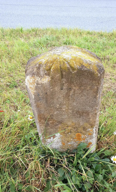
Image: © Tim Beer Taken: 3 Sep 2024
Stone post (plate lost) by the UC road (was A303), in parish of Horton (South Somerset District), West of Horton Cross, near junction with Sugg's Lane, on wide grass verge, between road and footpath, on South side of road. Ilminster iron plate, erected by the Honiton & Ilminster turnpike trust in the 19th century. Inscription once read:- (ILMINSTER) (2) (HONITON) (14½) One plate above the other. Rivet benchmark on top back. Grade II listed. List Entry Number: 1174847 https://historicengland.org.uk/listing/the-list/list-entry/1174847 Milestone Society National ID: SO_IMHO02
Images are licensed for reuse under creativecommons.org/licenses/by-sa/2.0
Image Location
Latitude
50.931781
Longitude
-2.95063