Archaeological excavation
Introduction
The photograph on this page of Archaeological excavation by Richard Sutcliffe as part of the Geograph project.
The Geograph project started in 2005 with the aim of publishing, organising and preserving representative images for every square kilometre of Great Britain, Ireland and the Isle of Man.

There are currently over 7.5m images from over 14,400 individuals and you can help contribute to the project by visiting https://www.geograph.org.uk
Archaeological excavation
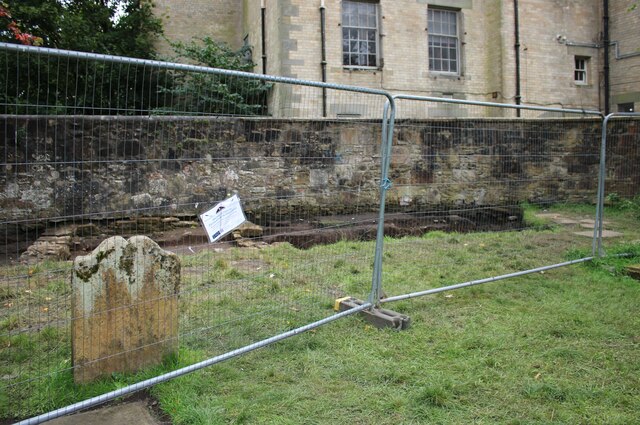
Image: © Richard Sutcliffe Taken: 1 Sep 2024
A small excavation beside the boundary wall in the southeastern part of the graveyard at Govan Old Parish Church. There have been excavations here over many years. One had just finished the day before, but would continue towards the end of September. Volunteers were being encouraged to take part, with preference given to those who lived in Govan. The churchyard is a Scheduled Monument https://portal.historicenvironment.scot/designation/SM10393, on account of the collection of medieval stones found within it (the Govan Stones) and now on display within the church itself.
Images are licensed for reuse under creativecommons.org/licenses/by-sa/2.0
Image Location
Latitude
55.863797
Longitude
-4.31244