Boundary stone, Shelley Bank Bottom
Introduction
The photograph on this page of Boundary stone, Shelley Bank Bottom by Humphrey Bolton as part of the Geograph project.
The Geograph project started in 2005 with the aim of publishing, organising and preserving representative images for every square kilometre of Great Britain, Ireland and the Isle of Man.

There are currently over 7.5m images from over 14,400 individuals and you can help contribute to the project by visiting https://www.geograph.org.uk
Boundary stone, Shelley Bank Bottom
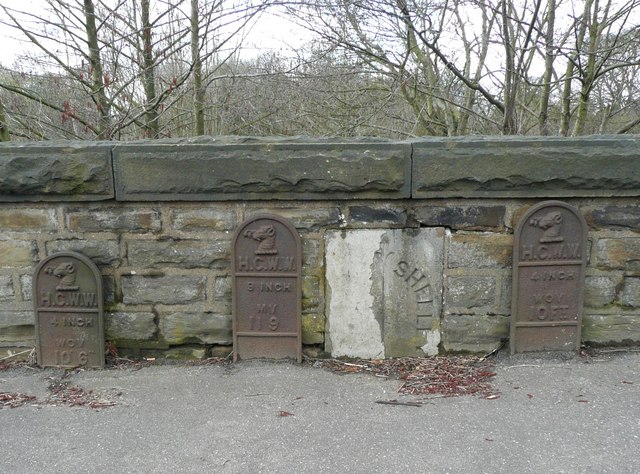
Image: © Humphrey Bolton Taken: 17 Apr 2008
Unfortunately the top layer of the sandstone has peeled off on the left side, which should read “Shepley”. Strange that two adjacent townships should have such similar names. The iron plates are for Huddersfield Corporation Water Works mains.
Images are licensed for reuse under creativecommons.org/licenses/by-sa/2.0
Image Location
Latitude
53.592496
Longitude
-1.697801