Old Milestone by the A59, Preston New Road, east of the M6
Introduction
The photograph on this page of Old Milestone by the A59, Preston New Road, east of the M6 by Ashley Preston as part of the Geograph project.
The Geograph project started in 2005 with the aim of publishing, organising and preserving representative images for every square kilometre of Great Britain, Ireland and the Isle of Man.

There are currently over 7.5m images from over 14,400 individuals and you can help contribute to the project by visiting https://www.geograph.org.uk
Old Milestone by the A59, Preston New Road, east of the M6
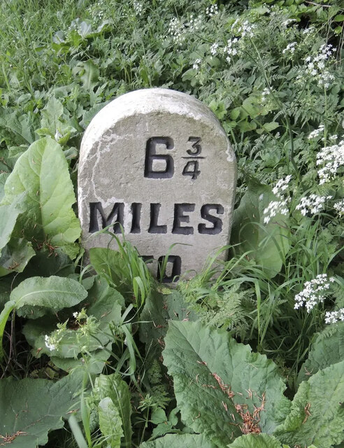
Image: © Ashley Preston Taken: 29 Aug 2024
Carved stone post by the A59, in parish of SAMLESBURY (SOUTH RIBBLE District), Preston New Road, 400m East of the M6, eastbound carriageway on verge, on South side of road. Salmesbury stone, erected by the Blackburn & Preston turnpike trust in the 19th century. Inscription reads:- : 3 / MILES / TO / PRESTON : : 6¾ / MILES / TO / BLACKBURN : Milestone Society National ID: LA_PSBBA03.
Images are licensed for reuse under creativecommons.org/licenses/by-sa/2.0
Image Location


Leaflet Map data © OpenStreetMap
Latitude
53.765522
Longitude
-2.629297