Benchmark on south face of south pier of east parapet of railway bridge south of Dockray
Introduction
The photograph on this page of Benchmark on south face of south pier of east parapet of railway bridge south of Dockray by Roger Templeman as part of the Geograph project.
The Geograph project started in 2005 with the aim of publishing, organising and preserving representative images for every square kilometre of Great Britain, Ireland and the Isle of Man.

There are currently over 7.5m images from over 14,400 individuals and you can help contribute to the project by visiting https://www.geograph.org.uk
Benchmark on south face of south pier of east parapet of railway bridge south of Dockray
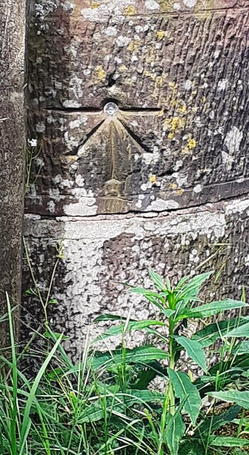
Image: © Roger Templeman Taken: 15 May 2024
Ordnance Survey 1GL bolt benchmark levelled at 27.024m above Newlyn Datum verified 1972. The mark was previously levelled at 88.423 feet above Liverpool Datum during the 1843/4 Kendal to Carlisle 1GL Survey. The surveyor's description was 'No. 345. Bolt in South-east pier of Dockeray Bridge, over railway ; 1.66 below battlement'
Images are licensed for reuse under creativecommons.org/licenses/by-sa/2.0
Image Location


Leaflet Map data © OpenStreetMap
Latitude
54.833911
Longitude
-3.14108