Turner Avenue Estate N15
Introduction
The photograph on this page of Turner Avenue Estate N15 by John Kingdon as part of the Geograph project.
The Geograph project started in 2005 with the aim of publishing, organising and preserving representative images for every square kilometre of Great Britain, Ireland and the Isle of Man.

There are currently over 7.5m images from over 14,400 individuals and you can help contribute to the project by visiting https://www.geograph.org.uk
Turner Avenue Estate N15
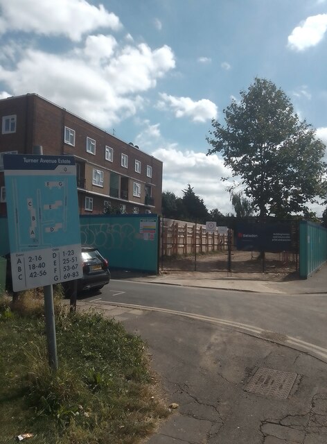
Image: © John Kingdon Taken: 11 Aug 2024
Taken on a blazing hot day with temperatures up to 31 degrees centigrade. This photo shows block D of the 1950's council estate to the left and, to the right, the works entrance to Brunel Walk where new council homes are being constructed on the site of the now demolished 1970's substandard council homes. My photo {{{7812983}}} shows the other works entrance to the Brunel Walk site. The neglected state of the pavement and grass show poor maintenance of the existing estate although the buildings are in good condition.
Images are licensed for reuse under creativecommons.org/licenses/by-sa/2.0
Image Location
Latitude
51.584885
Longitude
-0.081439