The Hayes, Newport Road, Stafford
Introduction
The photograph on this page of The Hayes, Newport Road, Stafford by Rod Grealish as part of the Geograph project.
The Geograph project started in 2005 with the aim of publishing, organising and preserving representative images for every square kilometre of Great Britain, Ireland and the Isle of Man.

There are currently over 7.5m images from over 14,400 individuals and you can help contribute to the project by visiting https://www.geograph.org.uk
The Hayes, Newport Road, Stafford
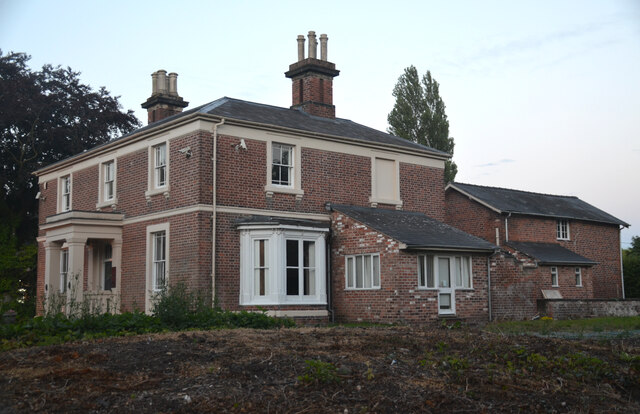
Image: © Rod Grealish Taken: 9 Aug 2024
A uninterrupted view of The Hayes after several mature trees were removed. The house was built about 1850 and is grade-II listed. For the last 30 years it has been used for commercial purposes but is now being turned back to domestic use.
Images are licensed for reuse under creativecommons.org/licenses/by-sa/2.0
Image Location
Latitude
52.801522
Longitude
-2.124402