The Midshires Way and Notts Wolds Way leaving Wysall
Introduction
The photograph on this page of The Midshires Way and Notts Wolds Way leaving Wysall by Tim Heaton as part of the Geograph project.
The Geograph project started in 2005 with the aim of publishing, organising and preserving representative images for every square kilometre of Great Britain, Ireland and the Isle of Man.

There are currently over 7.5m images from over 14,400 individuals and you can help contribute to the project by visiting https://www.geograph.org.uk
The Midshires Way and Notts Wolds Way leaving Wysall
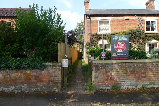
Image: © Tim Heaton Taken: 1 Aug 2024
The 'Stop the Solar Industrial Zone' relates to the proposed 'Old Wood Energy Park' - a solar farm with an export capacity of 49.9 MW, and a battery storage " .. capacity of 85MW .." [MWh ?] north-east of Wysall https://exagen.co.uk/wp-content/uploads/2023/05/OldWood-CommunityConsultaion-A5-Digital.pdf .
Images are licensed for reuse under creativecommons.org/licenses/by-sa/2.0
Image Location
Latitude
52.839021
Longitude
-1.104039