Milverton Wesleyan Methodist chapel
Introduction
The photograph on this page of Milverton Wesleyan Methodist chapel by Neil Owen as part of the Geograph project.
The Geograph project started in 2005 with the aim of publishing, organising and preserving representative images for every square kilometre of Great Britain, Ireland and the Isle of Man.

There are currently over 7.5m images from over 14,400 individuals and you can help contribute to the project by visiting https://www.geograph.org.uk
Milverton Wesleyan Methodist chapel
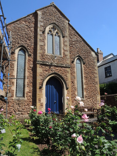
Image: © Neil Owen Taken: 18 Jun 2024
Dissenting parishioners were holding meetings in the 1840s and asked for a chapel to be built. A parcel of land with a stable and workshops, part of the Irongates Estate, was cleared and by 1850 a new place of worship erected for the sum of £222. Although relations between the two main church factions were frosty, the two now hold joint services. The chapel was refurbished in 1999 and many pews were removed for a carpetted space; it now holds popular tea and cake sessions.
Images are licensed for reuse under creativecommons.org/licenses/by-sa/2.0
Image Location
Latitude
51.025051
Longitude
-3.250436