Old Boundary Marker on Osborne Street, Colchester
Introduction
The photograph on this page of Old Boundary Marker on Osborne Street, Colchester by J Allinson as part of the Geograph project.
The Geograph project started in 2005 with the aim of publishing, organising and preserving representative images for every square kilometre of Great Britain, Ireland and the Isle of Man.

There are currently over 7.5m images from over 14,400 individuals and you can help contribute to the project by visiting https://www.geograph.org.uk
Old Boundary Marker on Osborne Street, Colchester
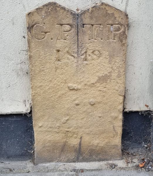
Image: © J Allinson Taken: 1 Jul 2024
Parish Boundary Marker on the south side of Osborne Street, Colchester, against the front of no.36A. Inscribed G.P.│ T.P. / 1819. On the former boundary of Holy Trinity and St Giles parishes. Milestone Society National ID: EX_COLC20pb
Images are licensed for reuse under creativecommons.org/licenses/by-sa/2.0
Image Location
Latitude
51.887549
Longitude
0.899746