Old Boundary Marker on the A1086 Easington Road
Introduction
The photograph on this page of Old Boundary Marker on the A1086 Easington Road by D Phillips as part of the Geograph project.
The Geograph project started in 2005 with the aim of publishing, organising and preserving representative images for every square kilometre of Great Britain, Ireland and the Isle of Man.

There are currently over 7.5m images from over 14,400 individuals and you can help contribute to the project by visiting https://www.geograph.org.uk
Old Boundary Marker on the A1086 Easington Road
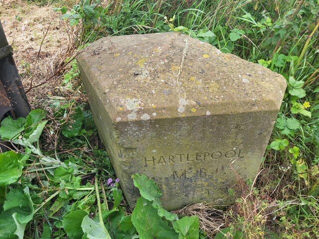
Image: © D Phillips Taken: 13 Jul 2024
Municipal Boundary Marker on the east side of the A1086 Easington Road, opposite Seaview Residential Park. Inscribed HARTLEPOOL / MB / 1ST AP / 1936. On the former boundary of Hart parish in Stockton RDC and Hartlepool parish and municipal borough Currently on the boundary of Hart parish and the Hartlepool unparished area, both in Hartlepool borough Milestone Society National ID: DU_HART03pb
Images are licensed for reuse under creativecommons.org/licenses/by-sa/2.0
Image Location
Latitude
54.718824
Longitude
-1.254847