The Cumbria Way near Nether Row
Introduction
The photograph on this page of The Cumbria Way near Nether Row by Adrian Taylor as part of the Geograph project.
The Geograph project started in 2005 with the aim of publishing, organising and preserving representative images for every square kilometre of Great Britain, Ireland and the Isle of Man.

There are currently over 7.5m images from over 14,400 individuals and you can help contribute to the project by visiting https://www.geograph.org.uk
The Cumbria Way near Nether Row
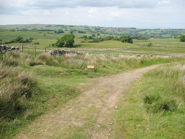
Image: © Adrian Taylor Taken: 11 Jun 2018
The Cumbria Way follows a public footpath along the old mine track from Potts Gill Mine to Nether Row, keeping right at this path junction (next photograph Image). The owner of Claybottom Farm has taken exception to cyclists using the public footpath through the farmyard and various signs have been erected to discourage this (see also the signs on Image). The unofficial looking wooden sign with arrow reads: ‘Footpath only ahead. Cyclists please follow the bridleway to Fellside’, but no bridleway exists from this location to Fellside! The path to the left is only a public footpath.
Images are licensed for reuse under creativecommons.org/licenses/by-sa/2.0
Image Location
Latitude
54.725375
Longitude
-3.054693