Litigan
Introduction
The photograph on this page of Litigan by Anne Burgess as part of the Geograph project.
The Geograph project started in 2005 with the aim of publishing, organising and preserving representative images for every square kilometre of Great Britain, Ireland and the Isle of Man.

There are currently over 7.5m images from over 14,400 individuals and you can help contribute to the project by visiting https://www.geograph.org.uk
Litigan
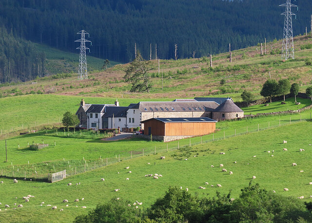
Image: © Anne Burgess Taken: 8 Jul 2024
A long-lens view of the farm buildings at Litigan. Note the horse mill - the circular building on the right. These were used for threshing grain. A horse was harnessed to a beam and walked round and round and round inside the mill, driving the millstones. See https://en.wikipedia.org/wiki/Horse_mill for a more detailed description.
Images are licensed for reuse under creativecommons.org/licenses/by-sa/2.0
Image Location
Latitude
56.624445
Longitude
-4.013986