Milestone with benchmark on top on NW side of A595 SW of Red Dial
Introduction
The photograph on this page of Milestone with benchmark on top on NW side of A595 SW of Red Dial by Roger Templeman as part of the Geograph project.
The Geograph project started in 2005 with the aim of publishing, organising and preserving representative images for every square kilometre of Great Britain, Ireland and the Isle of Man.

There are currently over 7.5m images from over 14,400 individuals and you can help contribute to the project by visiting https://www.geograph.org.uk
Milestone with benchmark on top on NW side of A595 SW of Red Dial
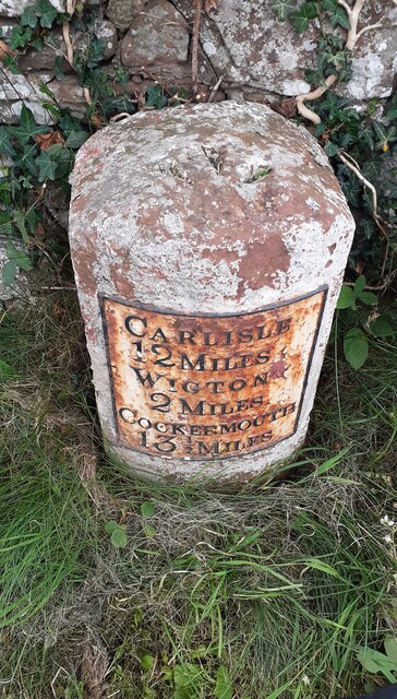
Image: © Roger Templeman Taken: 8 Jul 2024
Ordnance Survey pivot benchmark levelled at 72.442m above Newlyn Datum verified 1970
Images are licensed for reuse under creativecommons.org/licenses/by-sa/2.0
Image Location
Latitude
54.797378
Longitude
-3.17043