Graveyard of Kingswood Methodism
Introduction
The photograph on this page of Graveyard of Kingswood Methodism by Neil Owen as part of the Geograph project.
The Geograph project started in 2005 with the aim of publishing, organising and preserving representative images for every square kilometre of Great Britain, Ireland and the Isle of Man.

There are currently over 7.5m images from over 14,400 individuals and you can help contribute to the project by visiting https://www.geograph.org.uk
Graveyard of Kingswood Methodism
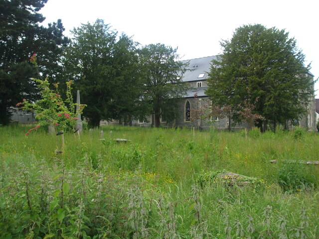
Image: © Neil Owen Taken: 29 May 2024
This part of Kingswood is richly endowed with the origins of Methodism. With the Wesley brothers and George Whitfield starting the move away from traditional church in the eighteenth century, a tabernacle was built in 1741 and Masters church (in the backdrop) in 1851 close by. The space between the two historic churches was used as a graveyard. Sadly as the Tabernacle and Masters churches have suffered neglect and arson after their services were ended, the graves have been neglected too. In recent years the two listed buildings have been given a new lease of life and there are plans to turn the graveyard into a pocket park, leaving some forty burials in place.
Images are licensed for reuse under creativecommons.org/licenses/by-sa/2.0
Image Location
Latitude
51.463157
Longitude
-2.506353