Medieval Cross, Ashton Keynes
Introduction
The photograph on this page of Medieval Cross, Ashton Keynes by Mr Red as part of the Geograph project.
The Geograph project started in 2005 with the aim of publishing, organising and preserving representative images for every square kilometre of Great Britain, Ireland and the Isle of Man.

There are currently over 7.5m images from over 14,400 individuals and you can help contribute to the project by visiting https://www.geograph.org.uk
Medieval Cross, Ashton Keynes
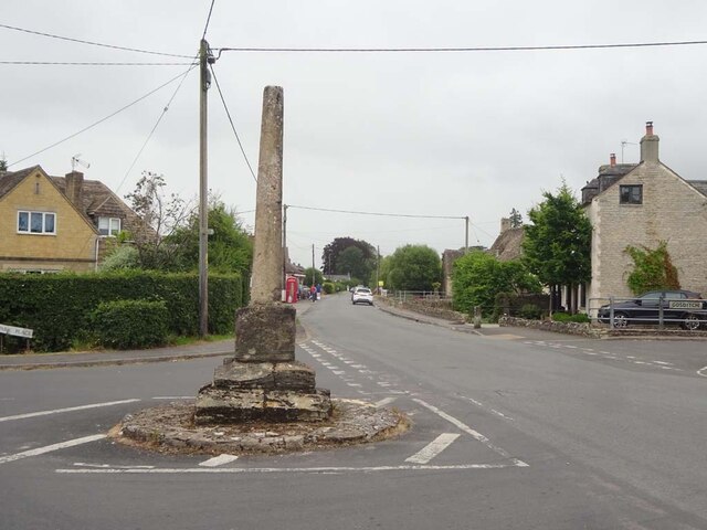
Image: © Mr Red Taken: 30 Jun 2024
Wayside Cross in the junction of Park Place and High Road, outside the White Hart pub. 14 or 15 C moved to present position in 20C. Scheduled Monument and Grade II listed Nᴼ 1356085 https://historicengland.org.uk/listing/the-list/list-entry/1356085 Milestone Society National ID: tbc
Images are licensed for reuse under creativecommons.org/licenses/by-sa/2.0
Image Location


Leaflet Map data © OpenStreetMap
Latitude
51.645051
Longitude
-1.935236