Murivance House and Allatt House
Introduction
The photograph on this page of Murivance House and Allatt House by Richard Law as part of the Geograph project.
The Geograph project started in 2005 with the aim of publishing, organising and preserving representative images for every square kilometre of Great Britain, Ireland and the Isle of Man.

There are currently over 7.5m images from over 14,400 individuals and you can help contribute to the project by visiting https://www.geograph.org.uk
Murivance House and Allatt House
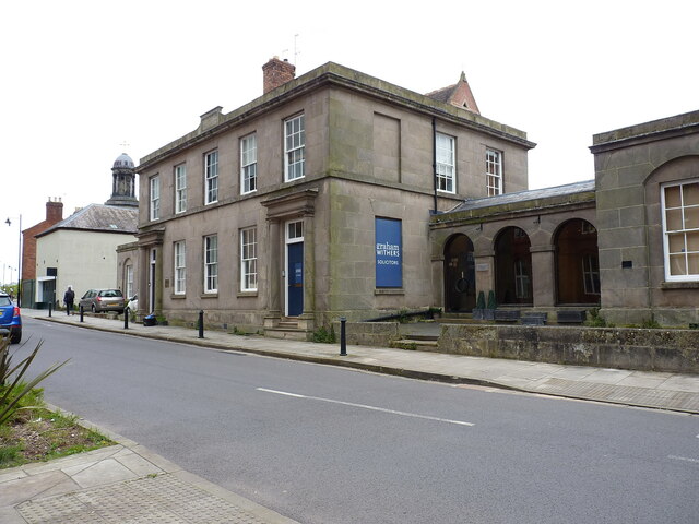
Image: © Richard Law Taken: 25 Apr 2024
Originally built around 1800 to a design by John Hiram Haycock, for John Allatt of the town, as a school. It later became the Shrewsbury Corporation Health Centre, and is now offices. The main building here, plus the pair of flanking pavilions and the arched arcades on each side, was Grade II listed https://historicengland.org.uk/listing/the-list/list-entry/1254663 & https://britishlistedbuildings.co.uk/101254663-murivance-house-and-allatt-house-shrewsbury in 1953.
Images are licensed for reuse under creativecommons.org/licenses/by-sa/2.0
Image Location
Latitude
52.706007
Longitude
-2.757504