Southern portal of Blisworth Tunnel
Introduction
The photograph on this page of Southern portal of Blisworth Tunnel by Stephen Dawson as part of the Geograph project.
The Geograph project started in 2005 with the aim of publishing, organising and preserving representative images for every square kilometre of Great Britain, Ireland and the Isle of Man.

There are currently over 7.5m images from over 14,400 individuals and you can help contribute to the project by visiting https://www.geograph.org.uk
Southern portal of Blisworth Tunnel
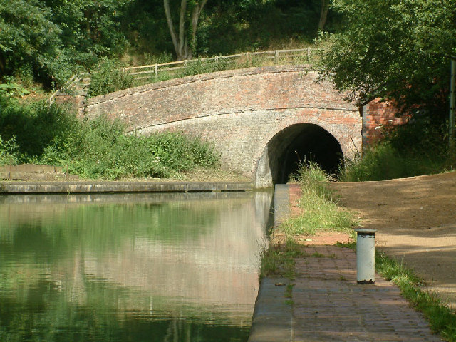
Image: © Stephen Dawson Taken: 10 Jul 2004
Blisworth Tunnel is a tunnel on the Grand Union Canal between the villages of Stoke Bruerne (southern end) and Blisworth (northern end). At 3076 yards (2813 metres) long it is the third-longest navigable canal tunnel on the UK canal network. Construction started in 1793, but after three years work it collapsed due to quicksand, claiming the lives of fourteen men. It was then decided to begin again with a new tunnel, which was not complete until March 1805, five years after the rest of the canal was open. The gap was filled by a temporary horse-drawn tramway over the top of the hill, with goods being transported from boat to wagon and back again. The tramway, built in 1801, was Northamptonshire's first railway.
Images are licensed for reuse under creativecommons.org/licenses/by-sa/2.0
Image Location


Leaflet Map data © OpenStreetMap
Latitude
52.147906
Longitude
-0.927249