St John the Evangelist, Hanley
Introduction
The photograph on this page of St John the Evangelist, Hanley by Jonathan Hutchins as part of the Geograph project.
The Geograph project started in 2005 with the aim of publishing, organising and preserving representative images for every square kilometre of Great Britain, Ireland and the Isle of Man.

There are currently over 7.5m images from over 14,400 individuals and you can help contribute to the project by visiting https://www.geograph.org.uk
St John the Evangelist, Hanley
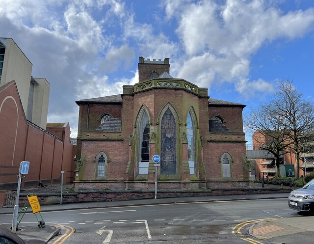
Image: © Jonathan Hutchins Taken: 29 Mar 2024
Originally constructed in 1737 and closed in 1985 when the tower was declared unsafe, the church is Grade II* listed: the official list entry is here https://historicengland.org.uk/listing/the-list/list-entry/1210680?section=official-list-entry More informstion can be found on thepotteries.org website including an interesting 2007 essay 'Ragged Glory' by David Proudlove: https://www.thepotteries.org/heritage/st_john_hanley.htm
Images are licensed for reuse under creativecommons.org/licenses/by-sa/2.0
Image Location
Latitude
53.027899
Longitude
-2.174853