Chettle Court London N8
Introduction
The photograph on this page of Chettle Court London N8 by John Kingdon as part of the Geograph project.
The Geograph project started in 2005 with the aim of publishing, organising and preserving representative images for every square kilometre of Great Britain, Ireland and the Isle of Man.

There are currently over 7.5m images from over 14,400 individuals and you can help contribute to the project by visiting https://www.geograph.org.uk
Chettle Court London N8
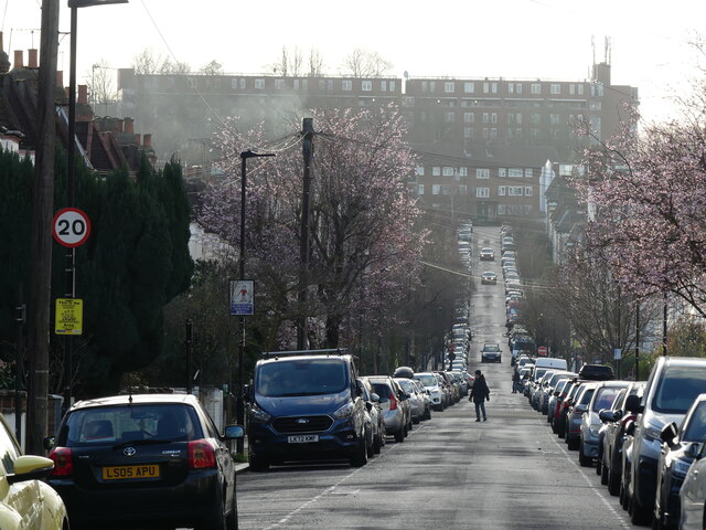
Image: © John Kingdon Taken: 18 Feb 2024
Looking west down Roseberry Gardens, across Green Lanes and up Duckett Road (which crosses over the New River) the eye first meets the block of flats, "Milverton", on Wightman Road. Looming above that is Chettle Court, a large 1960's Council housing development that stands on the edge of a deep cutting in which runs the Kings Cross to Edinburgh main railway line. Within the space of half a mile that's two roads, one man made river and a railway all heading north- south through Haringey.
Images are licensed for reuse under creativecommons.org/licenses/by-sa/2.0
Image Location
Latitude
51.578735
Longitude
-0.106955