Ancient crossroads site? Melton Road (B6047) crossing Gartree Road
Introduction
The photograph on this page of Ancient crossroads site? Melton Road (B6047) crossing Gartree Road by Tim Heaton as part of the Geograph project.
The Geograph project started in 2005 with the aim of publishing, organising and preserving representative images for every square kilometre of Great Britain, Ireland and the Isle of Man.

There are currently over 7.5m images from over 14,400 individuals and you can help contribute to the project by visiting https://www.geograph.org.uk
Ancient crossroads site? Melton Road (B6047) crossing Gartree Road
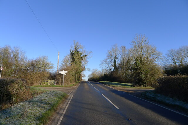
Image: © Tim Heaton Taken: 18 Jan 2024
Climbing up to a major watershed divide, the B6047 is believed to follow the route of an ancient north-south track through central England; this section known as 'le Ferdgate' in the Middle Ages (Michael Wood, 2010, The Story of England). Here it crosses the route of the Roman road, Via Devana. The two tracks would have given convenient access to the Gartree Hundred's moot site, which is believed to have been just 100 metres off to the left of the crossing Image
Images are licensed for reuse under creativecommons.org/licenses/by-sa/2.0
Image Location
Latitude
52.567636
Longitude
-0.943005