Chepstow Castle, Monmouthshire, taken 1965
Introduction
The photograph on this page of Chepstow Castle, Monmouthshire, taken 1965 by William Matthews as part of the Geograph project.
The Geograph project started in 2005 with the aim of publishing, organising and preserving representative images for every square kilometre of Great Britain, Ireland and the Isle of Man.

There are currently over 7.5m images from over 14,400 individuals and you can help contribute to the project by visiting https://www.geograph.org.uk
Chepstow Castle, Monmouthshire, taken 1965
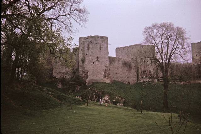
Image: © William Matthews Taken: Unknown
Chepstow is a Norman castle perched high above the banks of the river Wye in southeast Wales. Construction began at Chepstow in 1067, less than a year after William the Conqueror was crowned King of England. While Edward had his master castle builder in the person of James of St. George, the Conqueror, some 200 years earlier, had his equal in the person of his loyal Norman lord William FitzOsbern. FitzOsbern's fortresses were the vehicles from which the new king consolidated control of his newly conquered lands. Chepstow Castle became the key launching point for expeditions into Wales, expeditions that eventually subdued the rebellious population. http://www.castlewales.com/chepstow.html
Images are licensed for reuse under creativecommons.org/licenses/by-sa/2.0
Image Location
Latitude
51.643466
Longitude
-2.678602