Mysterious private land off Gravel Hill, Swanmore
Introduction
The photograph on this page of Mysterious private land off Gravel Hill, Swanmore by Peter Facey as part of the Geograph project.
The Geograph project started in 2005 with the aim of publishing, organising and preserving representative images for every square kilometre of Great Britain, Ireland and the Isle of Man.

There are currently over 7.5m images from over 14,400 individuals and you can help contribute to the project by visiting https://www.geograph.org.uk
Mysterious private land off Gravel Hill, Swanmore
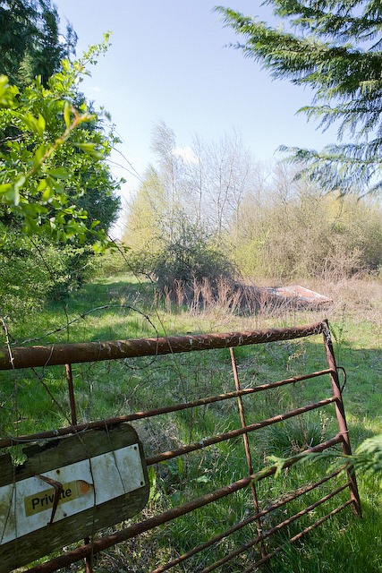
Image: © Peter Facey Taken: 17 Apr 2008
Evidently not accessed by vehicle for some time. A significant plot containing, from the aerial view, what looks like a collapsed glasshouse plus another substantial building with no other means of access. I did not venture within. It looks like a good place to build a house so, of course, you won't get planning permission to do so. One of the advantages of Google Earth aerial images being five years or more older than maps.live is that you can see how things have changed. Go to the links page and compare the two aerial views of this place. It's clear it used to be some kind of nursery or market garden, now totally abandoned. Update 2012: This site used to be known as "Swanmore Garden Centre". It is in an area designated only for uses essential to agriculture. Four planning applications were made between 1978 and 1993, to put a wood shed, bungalow, caravan, and finally a mobile home on the site; all were refused. So the land is derelict because the planners will not allow anything useful to be done with it.
Images are licensed for reuse under creativecommons.org/licenses/by-sa/2.0
Image Location
Latitude
50.933815
Longitude
-1.179553