Uplyme from Whitty Hill
Introduction
The photograph on this page of Uplyme from Whitty Hill by David Purchase as part of the Geograph project.
The Geograph project started in 2005 with the aim of publishing, organising and preserving representative images for every square kilometre of Great Britain, Ireland and the Isle of Man.

There are currently over 7.5m images from over 14,400 individuals and you can help contribute to the project by visiting https://www.geograph.org.uk
Uplyme from Whitty Hill
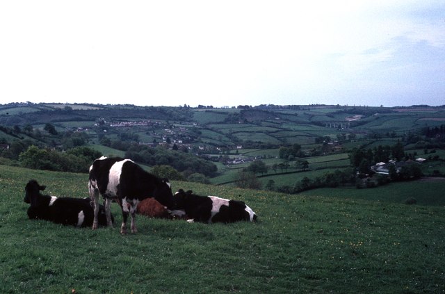
Image: © David Purchase Taken: 17 May 1966
Uplyme is seen centre and left of the photo. To the right, Cannington Viaduct Image can be seen with a chalk quarry behind it. The viaduct was one of the first mass (unreinforced) concrete viaducts in Britain, and carried the branch line to Lyme Regis which opened in 1903 and closed in 1965. Although nearby Lyme Regis is in Dorset, Uplyme and everything in this photo is in Devon.
Images are licensed for reuse under creativecommons.org/licenses/by-sa/2.0
Image Location
Latitude
50.734907
Longitude
-2.959986