Corner of New Street & Fieldgate Lane, Kenilworth
Introduction
The photograph on this page of Corner of New Street & Fieldgate Lane, Kenilworth by A J Paxton as part of the Geograph project.
The Geograph project started in 2005 with the aim of publishing, organising and preserving representative images for every square kilometre of Great Britain, Ireland and the Isle of Man.

There are currently over 7.5m images from over 14,400 individuals and you can help contribute to the project by visiting https://www.geograph.org.uk
Corner of New Street & Fieldgate Lane, Kenilworth
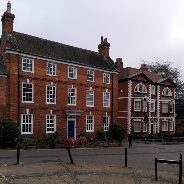
Image: © A J Paxton Taken: 10 Oct 2023
On the left stand 1 & 2 Fieldgate Lane, dating from the early 18th century, according to the listing at Historic England https://historicengland.org.uk/listing/the-list/list-entry/1365690?section=official-list-entry . On the right on Bridge Street is Abbotsford House, also a listed building and dating from the late 18th century, according to the listing. It was once known as Bridge House and during the First World War it housed Belgian refugees. When they moved out, Abbotsford School moved in and it acquired its current name. By 2018 the school had moved again and the house was being converted into flats; see the site of the Kenilworth History & Archaeology Society https://www.khas.co.uk/bridge-street-from-high-street-then-now/ . Between the two houses, New Street empties traffic from Coventry, including double decker buses, into the old town.
Images are licensed for reuse under creativecommons.org/licenses/by-sa/2.0
Image Location
Latitude
52.350051
Longitude
-1.581006