Horning Ferry Windmill
Introduction
The photograph on this page of Horning Ferry Windmill by Colin Mitchell as part of the Geograph project.
The Geograph project started in 2005 with the aim of publishing, organising and preserving representative images for every square kilometre of Great Britain, Ireland and the Isle of Man.

There are currently over 7.5m images from over 14,400 individuals and you can help contribute to the project by visiting https://www.geograph.org.uk
Horning Ferry Windmill
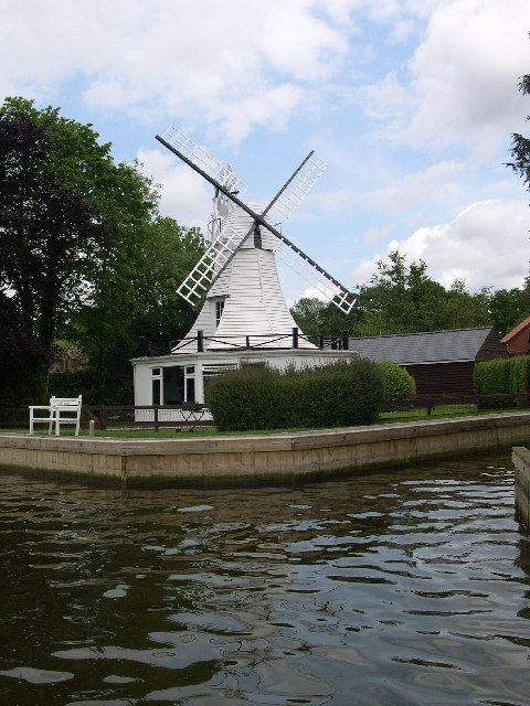
Image: © Colin Mitchell Taken: 30 May 2005
House conversion of an octagonal Dutch style smock windpump on the River Bure near Horning Village. Nearby (Image) is an interesting small open framed trestle windpump called "Hobb's Mill" - see Image
Images are licensed for reuse under creativecommons.org/licenses/by-sa/2.0
Image Location


Leaflet Map data © OpenStreetMap
Latitude
52.696261
Longitude
1.468964