Burstwick Methodist Church
Introduction
The photograph on this page of Burstwick Methodist Church by Paul Glazzard as part of the Geograph project.
The Geograph project started in 2005 with the aim of publishing, organising and preserving representative images for every square kilometre of Great Britain, Ireland and the Isle of Man.

There are currently over 7.5m images from over 14,400 individuals and you can help contribute to the project by visiting https://www.geograph.org.uk
Burstwick Methodist Church
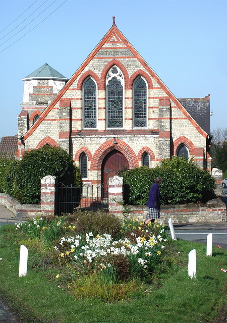
Image: © Paul Glazzard Taken: 15 Apr 2008
Primitive Methodist Church at the junction of Station Road and Back Lane, Burstwick. Until recently the church had a spire http://www.geograph.org.uk/photo/209349 but this was taken down in December 2007, presumably before it fell down. The wooden framework of the bell tower had been looking a bit tatty for some time, causing the slate roofed spire to lean ever so slightly out over the road.
Images are licensed for reuse under creativecommons.org/licenses/by-sa/2.0
Image Location
Latitude
53.730547
Longitude
-0.141408