Old Milestone by A4135, Draycott
Introduction
The photograph on this page of Old Milestone by A4135, Draycott by Roadside Relics as part of the Geograph project.
The Geograph project started in 2005 with the aim of publishing, organising and preserving representative images for every square kilometre of Great Britain, Ireland and the Isle of Man.

There are currently over 7.5m images from over 14,400 individuals and you can help contribute to the project by visiting https://www.geograph.org.uk
Old Milestone by A4135, Draycott
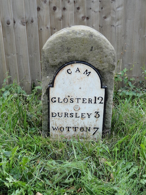
Image: © Roadside Relics Taken: 21 Jul 2023
The Milestone is located just South railway bridge in service road in front garden wall no 78 on the East of the road. Parish of Cam (Stroud District). Metal plate attached to stone post, Dursley plate design, erected by the Berkley & Dursley (Division) turnpike trust in the 19th Century, large chip LHS. An earlier photograph can be found here: https://www.geograph.org.uk/photo/1014941 Inscription reads:- GLOS'TER / 12 / DURSLEY 3 / WOTTON / 7 : : CAM Milestone Society National ID: GL_WEGL07
Images are licensed for reuse under creativecommons.org/licenses/by-sa/2.0
Image Location
Latitude
51.716202
Longitude
-2.365961