Manor Mill, Linfit, Lepton
Introduction
The photograph on this page of Manor Mill, Linfit, Lepton by Humphrey Bolton as part of the Geograph project.
The Geograph project started in 2005 with the aim of publishing, organising and preserving representative images for every square kilometre of Great Britain, Ireland and the Isle of Man.

There are currently over 7.5m images from over 14,400 individuals and you can help contribute to the project by visiting https://www.geograph.org.uk
Manor Mill, Linfit, Lepton
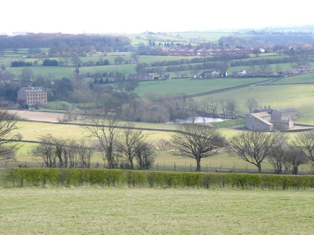
Image: © Humphrey Bolton Taken: 10 Apr 2008
The subject position is for the former Manor Mill on the right, and its millpond. The mill was disused by the mid-20C, so presumably has been converted to houses. On the left the tall building is Linfit Mill, at SE204137. Linfit Lane slants up the hillside, and becomes Paddock Road, passing a housing estate called The Crescent, at SE203131. A good proportion of SE2013 can be seen from this viewpoint at Little Lepton,
Images are licensed for reuse under creativecommons.org/licenses/by-sa/2.0
Image Location
Latitude
53.620355
Longitude
-1.696091