Top of part-buried benchmark bracket at north angle of Town Hall
Introduction
The photograph on this page of Top of part-buried benchmark bracket at north angle of Town Hall by Roger Templeman as part of the Geograph project.
The Geograph project started in 2005 with the aim of publishing, organising and preserving representative images for every square kilometre of Great Britain, Ireland and the Isle of Man.

There are currently over 7.5m images from over 14,400 individuals and you can help contribute to the project by visiting https://www.geograph.org.uk
Top of part-buried benchmark bracket at north angle of Town Hall
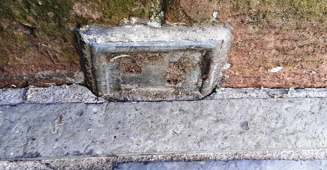
Image: © Roger Templeman Taken: 24 Oct 2023
Ordnance Survey documents indicate that this flush bracket which has serial identifier G518 (below pavement level) was levelled at 79.159m above Newlyn Datum in 1957 and verified in 1974
Images are licensed for reuse under creativecommons.org/licenses/by-sa/2.0
Image Location


Leaflet Map data © OpenStreetMap
Latitude
55.121767
Longitude
-3.355073