Holy Well on Spout Hill
Introduction
The photograph on this page of Holy Well on Spout Hill by Neil Owen as part of the Geograph project.
The Geograph project started in 2005 with the aim of publishing, organising and preserving representative images for every square kilometre of Great Britain, Ireland and the Isle of Man.

There are currently over 7.5m images from over 14,400 individuals and you can help contribute to the project by visiting https://www.geograph.org.uk
Holy Well on Spout Hill
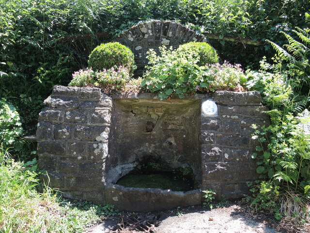
Image: © Neil Owen Taken: 13 Jun 2023
Just outside Shirenewton is a small water source on Spout Hill. It does not appears to be an ancient source nor associated with any particular saint. Following restoration the well and surrounds were rebuilt in 2000. Fortunately, the benchmark on the lower stone remains. See https://www.bench-marks.org.uk/bm205167 for the entry in the Benchmark Database.
Images are licensed for reuse under creativecommons.org/licenses/by-sa/2.0
Image Location
Latitude
51.640332
Longitude
-2.750231