Old Boundary Marker near Crewgarth
Introduction
The photograph on this page of Old Boundary Marker near Crewgarth by Colin Smith as part of the Geograph project.
The Geograph project started in 2005 with the aim of publishing, organising and preserving representative images for every square kilometre of Great Britain, Ireland and the Isle of Man.

There are currently over 7.5m images from over 14,400 individuals and you can help contribute to the project by visiting https://www.geograph.org.uk
Old Boundary Marker near Crewgarth
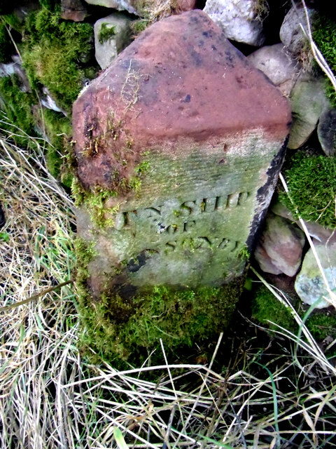
Image: © Colin Smith Taken: 9 Nov 2011
Parish Boundary Marker against the cobble wall on the south side of the road at Crewgarth. Inscribed PH OF / OUSBY for parish of Ousby and TN SHIP / OF / HUNSONBY for township of Hunsonby. On the boundary of Hunsonby and Winskill township in Addingham parish and Ousby Parish. This dates the stone earlier than 1866 when Hunsonby and Winskill parish was created. It was called just Hunsonby parish from 1934. Milestone Society National ID: CU_HUNOUS01pb
Images are licensed for reuse under creativecommons.org/licenses/by-sa/2.0
Image Location
Latitude
54.70869
Longitude
-2.62476