Trevor Gardens
Introduction
The photograph on this page of Trevor Gardens by Simon Carey as part of the Geograph project.
The Geograph project started in 2005 with the aim of publishing, organising and preserving representative images for every square kilometre of Great Britain, Ireland and the Isle of Man.

There are currently over 7.5m images from over 14,400 individuals and you can help contribute to the project by visiting https://www.geograph.org.uk
Trevor Gardens
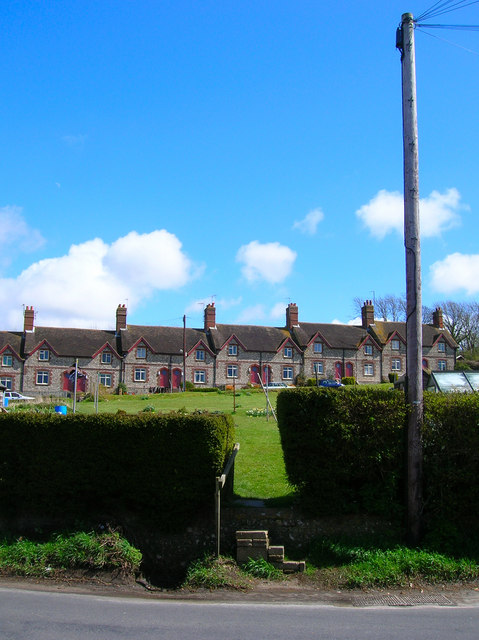
Image: © Simon Carey Taken: 12 Apr 2008
Built by the Glynde estate between 1879-91 to house workers employed in the nearby Brigden and Balcombe chalkpits. These are part of the terrace numbered 17-34 and are viewed from across the allotments.
Images are licensed for reuse under creativecommons.org/licenses/by-sa/2.0
Image Location
Latitude
50.857995
Longitude
0.070451